Sunday, July 31, 2011
City of Rocks: Emigrant Canyon
Sunday July 31 2011
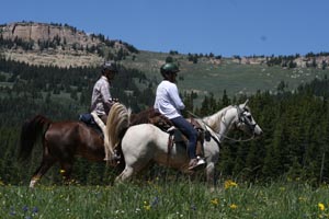
It just isn't every day you can follow a historic trail that tens of thousands of emigrants walked and rode and drove over 150 years ago, much less a trail in such a scenic area, in such good weather with such good footing.
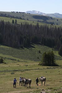
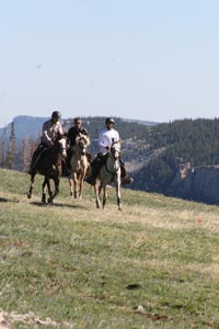
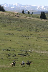
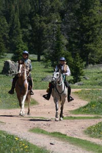
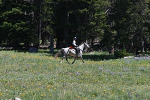
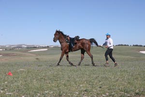
It was another fantastic riding day in and around City of Rocks National Reserve - a 19 mile loop, up a Canyon on a soft 2-track road, skirting Smoky Mountain (at the base of which is our probable ride camp for Steph's probable new multi-day endurance ride), intersecting the California Emigrant Trail (and the main road through the CORNR), to the Twin Sisters landmark.
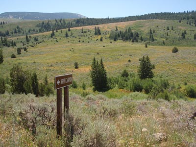
On down the road, riding on and paralleling the California Trail, we turned back down the Emigrant Canyon through which runs the old Salt Lake Alternate Emigrant Trail, and the old Boise-Kelton Stage Route.
This Salt Lake Alternate route was opened to wagon traffic in 1848. In 1869 the Boise-Kelton stage and freight traffic began using this route.
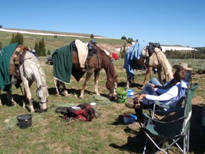
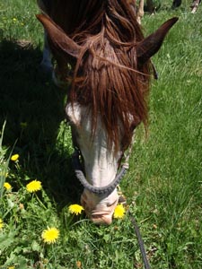
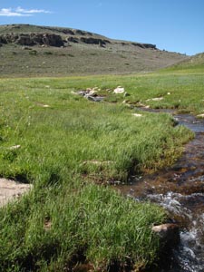
Half a mile down the canyon, you can see remnants of the old City of Rocks stage station. Stage stations were ideally located 10 to 15 miles apart on the emigrant trails, with water and grass for the horses. Our horses partook of both here. A smorgasbord of grass flanked our entire loop - Jose couldn't decide what he liked best, the rice grass, rye grass or crested wheat grass - and he could stuff his mouth full of all 3 in one bite in some places.
Footing was fantastic. We rolled at a good clip along most of the loop. When you're flying along one of these old trails, making time, you just can't help but think about those slow rolling wagon trains full of people laboring westward, heading to an unknown future and destination, other than "California" or "the West."
Jose enjoys the scenery as much as I do - while the other horses go on, he stops to look at things, and study and absorb what he's seeing. He's such a soulful horse, I sometimes wonder if he doesn't see into the past, things that happened at the historic places we pass.
[slide show here]
Saturday, July 30, 2011
Exploring City of Rocks: The High Trail
Saturday July 30 2011
We set out under a cool, overcast sky and headed for the high trails in City of Rocks National Reserve. Today's was a 14-mile loop, skirting the Circle Creek valley like yesterday, then climbing. Above the valley, up and up on great trails, from 5600' at basecamp to 7200', through forests of pinyon/juniper, passing into old stand aspen forests, up and up along the North Fork Circle Creek Trail. Even higher, monster granite outcroppings played hide and seek in a tall mahogany forest.
We gained a saddle in the trees, and like magic, a spring-fed water tank awaited our horses, along with a lush spot of grass.
We might have continued on to a higher ridge trail but for the gathering dark, somewhat ominous clouds foreshadowing the 30% chance of thunderstorms predicted for today. One rider voiced worry about being caught up on a high trail in a thunderstorm. The others agreed, but I think they were more worried about being caught with me up on a high trail in a thunderstorm. I don't do lightning well.
We descended an equally well-maintained trail down to Emery Pass on the main road through City of Rocks. It's a picnic area for humans and an idyllic picnic area for horses. They gorged on many kinds of shoulder-high grasses while we snacked and looked over maps. Climbers worked their way up the Bread Loaves. We marveled at the craziness of the climbers, and they probably thought the same of us, trotting merrily down the trail.
We headed back towards camp following a ridge trail - into darker clouds and scattered rain showers. Dropping down to the valley floor, a refreshing rain shower (no lightning!) enveloped us in the heavenly sage perfume of the desert.
The trails go on and on in the City of Rocks. We've not found one yet that is rocky or treacherous underfoot. The scenery makes your eyeballs water. No wonder people have been impressed with the place for 200 years.
We've found several possibilities for basecamps for a multi-day ride; we've found more possible trails in the BLM lands to the west, and possibilities for vet checks at an old cemetery and an old schoolhouse on the California Trail.
Steph knows an endurance rider who knows the person who owns the land we can ask for permission to use on parts of the California Trail. Lynn has connections who can find landowners we want to talk with. Juanita at the visitor center knows the area and locals and trails and is helping us figure out and plan things.
The doorways keep opening. The trails keep spreading out in front of us. Things just keep falling into place. A three or 5-day endurance ride is just inevitable here next year!
[slide show here]
Friday, July 29, 2011
Endurance Ride Fever
Friday July 29 2011
Gold Fever.
It's one of the main driving forces behind the flood of a quarter million emigrants that travelled overland to the West in the mid 1800's. Many of them found their way along the California Trail and laid eyes on the City of Rocks in what is now southern Idaho, at the southern end of the Albion Mountains.
It's Endurance Ride Fever that brings some people to places like this - the desire to ride well, and ride far, to explore beyond the boundaries; the hankering to show off and share beautiful country, the taste of dust, and the flavor of how it was in the old days for the pioneers.
We got a taste of the City of Rocks National Reserve today, riding a 10-mile loop around the valley of the City of Rocks, riding below soaring granite spires where turkey vultures soared on the updrafts. We trotted along a part of the California Trail, riding around Register Rock, where many emigrants wrote their names in axle grease, which you can still see today.
What we saw was the tip of the iceberg. What we saw only whetted our appetite.
We've got Endurance Ride Fever, bad.
[slide show here]
Thursday, July 28, 2011
Exploring Trails: The Albion Mountains
Thursday July 28 2011
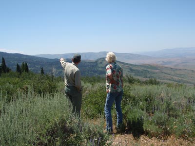
Hovering above, and reaching 30 miles northward beyond the City of Rocks are the Albion Mountains in southern Idaho. That's where we were headed with the Recreation Manager for the Minidoka Ranger District, to get a lay of the land and a tour of the road/trail system. David is an old friend of mine from my Forest Service trail work days and it's a delightful coincidence that he's here managing part of the area Steph is hankering to put on an endurance ride. Of course it's an added bonus that he knows the area well, knows horses, and welcomes horse use as part of the recreation on the district, even if it is a bunch of rabid endurance riders.
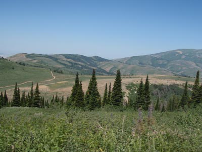
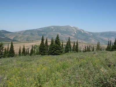
It's a scenic mountain range with captivating possibility of trails - loops around alpine lakes, and trails running all the way from City of Rocks, around Cache Peak, the highest point in Idaho ("south of the Snake River" : ), and - if we wanted to go that far, Mt Harrison.
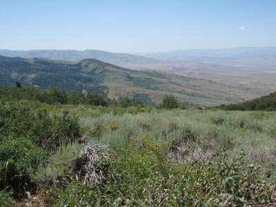
There's a ridgeline trail, through forests of pines, firs, and aspens, with sweeping views of the basins on the east and west sides of the mountains. The terrain is not too rugged nor too steep, nor the trails too rocky.
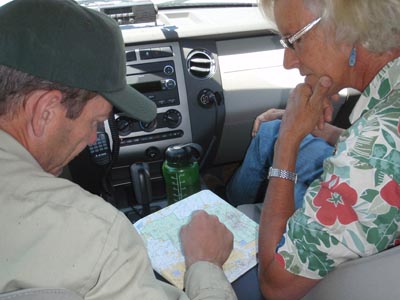
We poured over maps and looked at trailheads and schemed over the possibilities. Maybe one day a ride around City of Rocks. Maybe one day a ride from the City of Rocks up into the Albions. Maybe a ride just along the trails around the lakes in the mountains. Maybe all of that in a multi-day ride!
Time, exploring, and many hoofprints will tell.
Sunday, July 24, 2011
City of Rocks
Sunday July 24 2011
All it took was one glance at the City of Rocks National Reserve, south of Burley, Idaho, for Steph to become consumed with the idea putting on an endurance ride there.
Shoshone-Bannock Indians lived here before the pioneers' wagon trains blazed trails through the area beginning in 1843. The area was an important landmark for emigrants traveling the California Trail and the Salt Lake Alternate Trail, which pass through the south end of the park; if you know where to look, you can still see names and initials of emigrants written in axle grease on some of the boulders.
The park's name came from the description of James Wilkins, an emigrant passing through in 1849, who was impressed enough by the beauty of the landscape to write about it: "We encamped at the city of the rocks, a noted place from the granite rocks rising abruptly out of the ground. They are in a romantic valley clustered together, which gives them the appearance of a city." There are stories of a stage coach robbery from 120 years ago and buried loot under Treasure Rock. The area was established as a National Reserve in 1988.
The unique geological jumble of spires, pinacles, and monoliths is made up of granite as young as 28 million years old, and as old as 2.5 billion years. The rock forms make the City of Rocks one of the premier climbing destinations in the US. The hiking and bird watching is not bad either. Maybe endurance riding will gain a hoof-hold here too.
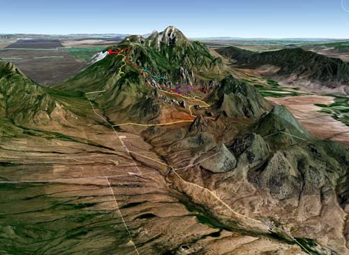
Steph quickly snapped up maps of the Reserve, the nearby accessible Castle Rocks State Park (all equestrian-friendly, with even a couple of equestrian camping slots in a campground), of the surrounding BLM and Forest Service lands. By mid-morning next day she'd surveyed the region on Google Earth (and became really obsessed - Google Earth will get you every time!), talked to the BLM guy, who didn't have much info to share on the area, and to the Forest Service Recreation manager, who happens to be an old acquaintance from my Forest Service trail work days, and who is meeting us there next week to show us around the FS mountain roads/trails. He didn't know offhand of some ranch that would volunteer for our basecamp, but he did know a lady with Missouri Foxtrotters who rides up there all the time. Steph also contacted endurance rider John Parke, who has relatives around there and who has wondered about an endurance ride in the area. I wonder if the in-laws would want 20-50 endurance riders camped in their front yards for a week?
Elevation in the 14,000-acre National Reserve is between 5,720' and 8,861'; trails go from the Reserve right on up into the Albion Mountains (part of the Sawtooth National Forest) where reportedly there's a Skyline Ridge trail in the mountains that's 26 miles. (Do that both directions and you've got a 50 mile ride for one day!)
This is how endurance rides get started: somebody loves some particular area and wants to share it with other riders.
I can't promise Steph won't have us belaying our horses down the pinnacles or our trailers up and down the ravines of Granite Pass like they did with the emigrant wagons, but she'll probably come up with some fine scenic trails.
If we can find enough good ones, you might want to mark your calendar for July 2012.
Saturday, July 23, 2011
Big Horn: Big Conclusion
Saturday July 23 2011
It's a rugged ride, this Big Horn 100. It's historic, legendary, magnetic, and it's been around a long time. It's been called "the longest continually running 100-mile race in North America", though the earliest reference to it I find is that the local riding club, the Canyon Cavaliers, "got the idea of doing a 100 mile ride in 1970". The first Tevis Cup 100-mile ride was held in 1955; perhaps the Big Horn statement refers to Tevis being cancelled because of fires in 2007. Regardless, the Big Horn 100 is one of the original, traditional, most beautiful, arduous, 100-mile rides in the country, and a silver Big Horn belt buckle is most coveted. Many people would probably name the Big Horn 100 in the top 3 rides in the country, along with Tevis and the Old Dominion.
And with the Big Ones, there always seems to be an aftermath in some form or another, with some participants.
The Incidents during the Big Horn 100 the last 8 years have been well documented. (Read the stories for yourself - http://www.endurance.net/international/USA/2010BigHorn/index.html and http://merritravels.endurance.net/2011/04/big-goal-big-horn.html.)
It doesn't mean people don't still love the Big Horn, and it doesn't mean that they don't still come to ride it. They do still come, they do still ride, and they do still love it, even with a chance that somebody's lottery number casts them as the ones who will have the It-Happened-To-Me-And-I-Survived tale to tell after it's over.
One of the consistent big problems with the Big Horn 100 appears to be lack of communication before, during and after the ride.
It's often hard to sift the truth from the rumors - and the rumors are plenty, because of lack of communication. Sometimes rumors are all that people have to go on. The following are some rumors/facts/guesses we heard before, during and after this year's ride, by people who knew, or said they knew, the area and the people involved with the ride, and by people participating in the ride. The Before Rumors affected Steph's and my decision to not ride the Big Horn this year. Whether the rumors were true or not, this was all we had to base our decisions on.
Rumors before the ride:
There is no snow on the trail/There is still snow on the trail.
The ride will be held on the flats, not in the Big Horn mountains, due to snow on the trail/The ride will be over the original Big Horn trail because the trails are clear of snow.
Rumors during the ride:
(At the ride meeting, where no Ride Manager/assistant Ride Manager was present):
The ride will be over the original Big Horn trail/There is a small detour/Some miles were added/ Some miles were subtracted.
The trail is well marked for the 100's/The trail is marked for the 50's/The trail is marked only on the left side of the trail in portions for the 50's/The trail has probably been marked for both directions in some places.
Rumors before, and during the ride:
The distance between vet checks 2 and 3 is 21/22/32/34/37 miles.
The vet check is just over the hill/The vet check is 8 miles away.
There's only one way off the mountain, you can't get lost/There were forks in the road-trail where no markings could be found indicating the way to go.
Rumors after the ride:
Breakfast and awards will be at 8:30 AM/9 AM/10 AM (There was no breakfast, and no Ride Manager was present while Tom Van Gelder handed out the completion certificates).
All the 50 milers were overtime/The 50 was changed to a 60 next morning and all riders got credit for finishing/Only half the riders got credit for finishing the 60.
The following is the big Snafu of this year's ride:
The last 5 riders to leave Vet check 2 at 2:30 PM were told the distance to vet check 3 was 22 miles (it was measured by our riders on GPS to be 34 miles). Based on that statement, and due to one of the horses getting into trouble on the loop, and because there is no way of communicating at all by radio or cell phone in the ride, 3 riders stopped; one backtracked on the trail and found a camper, woke him up and paid him to drive him the hour down to basecamp and find a vet to bring him up with treatment fluids followed by a trailer.
The other two riders went on to the vet check to get help, thinking they were close to the vet check as they were going by the "22 miles" they were told. They got lost in the dark because the vet check was not close because the mileage they were given was incorrect, and because of inadequate trail markings for nighttime. They were finally found and pointed in the right direction and eventually led (in another adventure! but that's another story) to the vet check 3, where they arrived at 1:30 AM to find only their crew members waiting. The veterinarians had packed up at 10 PM to leave (with 5 riders still unaccounted for). The two horses, who were thankfully fine, spent the night fed and blanketed in a corral there and the 2 riders and 3 crew spent the night crammed in their truck there on the mountain, waiting to hear news of their other 3 riders and horses. The 2 riders and 3 crew made it back to camp at 6:30 AM; their two horses were brought down around 10 AM. (The other 3 horses and riders arrived at basecamp around 5:30 AM).
The fact that the Ride Manager was not at the ride meeting 8 PM Friday night to explain the trail or answer questions because she was still out marking trail/got stuck out on the mountain, and there was no other official ride person who knew what to tell riders (the head vet did the best he could, but he didn't know anything about the trail) was very disconcerting.
The fact that the accurate trail mileage between vet checks seems to be unknown is disconcerting ("21/22 miles" and "32/34/37 miles" between vet checks 2 and 3 is a BIG difference in the wilderness halfway into a 100 mile ride),
The fact that the trail between vet checks 2 and 3 was not adequately marked for riding in the dark - especially with the mileage discrepancy - is disconcerting.
The fact that there was no veterinarian waiting at vet check three for 5 missing riders is disconcerting.
Thank goodness we had perfect weather all day, unlike last year.
Though I find it comforting that every year, the theme of this ride by some participants is, "I survived the Big Horn!" or "Nobody was hurt!", I find it unsettling that things keep happening at this ride and people seem to expect something to go wrong, whether it's Mother Nature, bad timing, inadequate preparation, lack of sufficient help, or whatever.
It can't be disputed that the Big Horn is a very challenging, extraordinarily beautiful ride. Both are big reasons people keep coming to do this historical ride every year.
It also can't be disputed that there are problems with this ride. A wise horseman and Hall of Famer once told me, If something's not working, try something else. There are clearly some things not working with the Big Horn 100 and it's time something else is tried.
As a paid member of AERC whose rules govern the sport, as an experienced endurance rider and as a crew person, as a rider who is responsible for the well-being of my horse, I have expectations at endurance rides I attend.
Comparisons to the other legendary ride, the Tevis, are inevitable.
At the Tevis, I can expect:
Well marked trail for daylight and dark, well ahead of time.
Exact mileages between vet checks and holds, and the fact that there will be veterinarians waiting at them until all riders are accounted for.
Ride management or representatives at the pre-ride meeting who know the trail, can explain the trail and adequately answer any questions about it.
Radio communication or cell phone communication. Some kind of plan for communication. Evacuation plans for humans and horses.
Plenty of help.
200 plus riders so the chances are, if you are in distress, somebody is going to pass you to help or get help.
Drag riders.
At the Big Horn, you simply can't expect this.
That said, whether or not your Ride Manager tells you what to expect at a ride, you should ALWAYS go into the wilderness, for a 100 mile, 34 mile, 21 mile, or 5 mile ride, prepared for anything. Weather can change radically on a mountain at 8000' in an hour. You can go from being hot in a tank top to hypothermic in minutes. (I learned this the hard way one day by myself unprepared with a pack string in the mountains.) A Ride Manager should not have to tell you to carry an extra jacket, flashlight, your insulin or juice if you're diabetic, enough water, some food, whatever you need to last you for if you do get lost in the wilderness. You could fall off your horse and hit your head 5 miles out of the vet check and be disoriented and die for lack of clothing and a light before getting yourself out or being found. Riders should just carry this gear with them (preferably on themselves, not the horse who might leave you).
And that being said, the Ride Management has a responsibility to provide the best effort for the best experience for riders and horses. 100 miles on an easy course is a tough thing to ask of your horse (and often the rider!). The Big Horn is not a flat, easy course. Unpredictable things can happen in endurance, especially on a 100 mile ride, especially on a 100 mile ride in the wilderness.
I just can't believe the Ride Management doesn't care; I DO think the Big Horn folks want to put on a perfect ride, but when the same incidents happen over and over, for whatever reason, something is clearly not working. Try something else. Ask for more volunteers or pay them. Raise the entry fee so the riders help pay for this (at $150, the entry fee for the Big Horn is one of the lowest entry fees for a 100 that I know of). Find or pay people to pre-ride and drag-ride the trail. Find or pay people for radio communications. Try something different. I think most all people, including me, want the Big Horn tradition to continue another 40 years, though as one old timer put it, "There are only 4 of us left who know the trail."
On the other hand, maybe there isn't a problem, and I've just gotten spoiled by other endurance rides I've been to. I know one person who has mentioned being frustrated, but maybe everybody is satisfied with or has accepted the Big Horn 100 the way it is. From people I talked to, and reactions I saw at the pseuo pre-ride meeting, some of this lack of preparation and communication and information were not surprising. Maybe most people come to ride the Big Horn knowing the shortcomings. Maybe they come because knowing this adds extra challenge and thrill to the ride, and makes the rewards that much greater when you do finish, or come out unscathed.
The Tevis is not a ride for lightweights, and the Big Horn is NOT a ride for sissies. Those who decide to ride in the Big Horn 100 are courageous and I admire you. Those who overcome adversities to survive the Big Horn are tough and I salute you. And I can't even begin to express veneration for the horses who complete the ride.
WIth things how they are, I'm not comfortable subjecting my horse - and in my case it's someone else's horse - to this ride. I'll crew for friends, and I'll help with the Big Horn ride if I am able to volunteer and if my help would be accepted, but it's no longer on my Bucket List of rides to attempt.
I'm just going to stick to sissy rides.
Friday, July 22, 2011
Big Horn 100: Photo Tales - Part III
Friday July 22 2011
We'd sort of gotten the directions to Vet Check 3... but we crossed a creek we weren't supposed to cross, and as the old logging road got windier and narrower as it went up and up, we thought this couldn't be right. "Look for the porta-potty, at the 50's vet check" we'd been told... but - way up here?
We crossed the Big Horn trail markers a couple of times, but that could have meant we were on the right road, or totally the wrong road. We were just about to turn around and go back down... somewhere, to find someone to ask (no cell phone coverage anywhere), when we happened upon a portapotty and the 50's vet check, where people still happened to be waiting.
"Keep going!" they waved us on. "It's just a couple miles. Pass the Snowshoe Lodge, pass over a cattle guard, you'll see flags turning you off to the right."
Hooray, we find all this, and then... nothing. We come to a gate with an unlocked lock on it and a sign that says "Private Property." Another crew guy is there in his pickup. "Do we go through this?" Heck, we didn't know. We both drove through and closed the gate behind us. The road deteriorated - thank goodness it wasn't wet or we might be stuck up here a couple of weeks - and we came to ANOTHER gate. This couldn't be right, we thought, and how much worse was the road going to get?
Just about when we were going to turn around and backtrack, we came around a corner to a beautiful mountain meadow busting with flowers and a meandering creek - and a portapotty, and Bill, Bev's crew husband and another truck or two. Yay, we'd found the vet check!
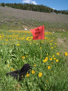
Some lucky humans also had a mountain hideaway tucked there at the end of the meadow (later they came over to visit, and much later they would assist some lost and tired riders and horses).
Then came... the waiting. The waiting is the hardest part. The boys had left Vet Check 2 at around 12:30; notwithstanding the "21" miles this section between vet checks 2 and 3 was supposed to be, we knew it would be much more (Tim French later confirmed it was 31 or 32, and our boys GPS'd it at 34 miles), and we were hoping to see them around 8:30 PM or so. We hoped. What to do for hours and hours? It only took so long to unpack the truck with the human and horse food and gear.
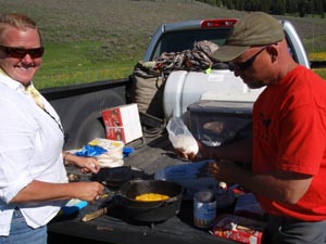
I worked on my computer a bit, I tried reading, and I dozed off in a chair. Then: I ate, Oh, my God, did I eat. Joe Haeberle's parents, Yvette and John, took it upon themselves to cook food in Dutch ovens for everybody, right there at the vet check. I've had some good food and treats at endurance rides, but this was the ultimate. Fresh-out-of-the-oven wicked chicken fajitas (salad, and dressing on the side, too). If that was not most satisfying, they topped it off with killer peach cobbler topped with whipped cream. I thought I'd died and gone to heaven. I ate so much I got close to nirvana. They made another oven-full of peach cobbler but I had to stay away, though they tried to tempt me again.
Then to top that off, I made some coffee with my camp stove and French press, with the extra coffee grounds that Tim French had leftover (ground fresh!) from this morning. Steph and I had our fresh, strong coffee, and lounged around waiting. I was really getting the hang of this crewing thing. Bad Tevis memories were fading. This crewing gig was not such a bad thing.
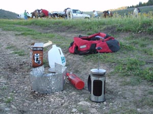
Since we still had hours more to wait, and I was in the serious Over-Done-It-Food stage, I went for a hike up the trail, a little stroll in the Big Horn mountains.
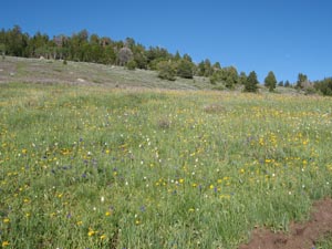
Along the old logging road, I surprised and met a deer and a grouse among the lodgepole pines, and wondered about cougars and bears, as I always do. There were moose in this mountain range too - Steph and I would see one of these magical beasts as we were driving out in the dark.
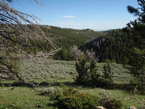
I trudged up an incline (difficult after a satiating meal!) and came out to a terrific view of the next valley, and thought of how it goes on and on - the Big Horn mountain range runs about 200 miles on a northwest/southeast line. It's something Kevin will mention at this vet check - "You go over one ridge, and the view is beautiful. You go over the next ridge, and the view is even more beautiful - after beautiful, after beautiful..."
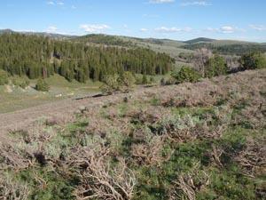
I kept thinking I'll see the leaders Bev Gray and Kerry Greear in the distance in the valley, but I didn't. I turned around to hike back to camp where people were still waiting.
It was around 7:30 PM when someone said "There they are!" A glimpse of something moving in the trees - a closer look proved it to be a gray horse and a pinto - and the yeehawing confirmed that the first two riders were coming into the vet check. We all echoed their hoots and hollers as they trotted down the road and came into view, then stopped to let their very thirsty horses drink out of the creek.
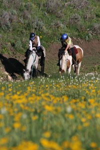
Bev's horse looked great, as did Kerry's. Bev said the trail had been marked great. At the same time, we heard that all the 50 milers were off trail and overtime (the same trail the 100's were riding in reverse).
The hold was half an hour, and the sun was just sinking behind the hill as Bev and Kerry trotted out onto the trail for their last piece of trail ("25 miles" or so), and the next bunch came in - Andy and Brandon Bown, Bill Brown (it was Bill and his horse's first 100), and another guy whose name I didn't know. Brandon was looking pretty wiped out. Somebody get that boy a bottle of water!
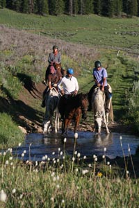
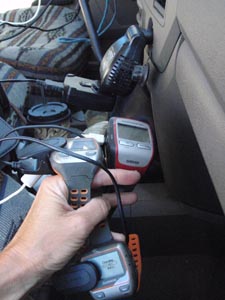
I made another French pressed pot of coffee that was waiting for Kevin, Kevin and Rusty when they arrived at the vet check, right around 8:30 PM. "That section was long! And hard!" But, they'd expected it. I grabbed their GPS's and plugged them into the truck to charge for half an hour. The horses still looked good after around 73 miles (by GPS), and they ate and ate and ate.
The horses already had glowsticks on the breast collars, which were broken so they'd light up. The boys duct taped headlamps to their helmets, and reloaded on water and ibuprofen. Kevin M's ankle was stiffening up a bit - he and Far had taken a tumble a week before the Big Horn. Far was fine, but Kevin had bruised his hip and sprained his ankle, and it was making some noise now.
With the sinking of the sun, it cooled down quickly with the brisk breeze; it was hard to decide what to wear for the two dozen miles of trail, which would probably take 5-6 hours. It would be hot down on the valley floor, but in the wilderness, you really don't want to be stuck without extra clothing.
The half hour blew by quickly and soon the boys were mounted up and headed out of the vet check. "See you at Trapper Creek," we said - a meeting place down on the valley floor about 7 miles (or thereabouts, nobody was sure) from camp. It was totally voluntary, but coming out of the mountains (we heard from last year's veterans), the horses are in need of water and grateful for hay, and humans are grateful beyond words for water or other pick-me-ups for the last miles into camp. The moon would be up soon, so they'd have some of Mother Nature's light to help them along their way.
Steph and I packed up the pickup and headed out. Five riders - the Stalleys and Lisa Schneider - were still out, but they should have been coming in soon, as they had been less than an hour behind our boys coming into the last vet check.
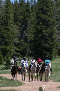
One rider had been pulled here... in the fading light we wondered how long she'd be out here waiting for a ride for her horse. It didn't appear easy to get a trailer in here, and there wasn't one on the way (we never did see one, on our 90 minute drive back to camp). On the way out, we saw a moose!!!!
Just going back to camp and crawling into bed was soooooooooooo tempting, but we just couldn't not meet our boys at Trapper Creek. We didn't have great directions to this stop either, but we stumbled along a road at the base of the mountains - and were startled when we came across Bev and Kerry on their horses! We hadn't seen any markers on this road, but figured Bev and Kerry knew what they were doing. (Not long after, we heard someone drove after them to get them and turn them around - they'd missed their turn off of this road.)
We weren't sure where to stop ("near the river" but we couldn't see the river). We spotted a parked pickup, and at first we weren't sure it wasn't some local Shell teenagers' make-out spot, until the Haeberle's rolled down their window and said we were at the right spot.
Steph stayed in the truck to rest her eyes (and consequently passed out for a while) and I pulled up a chair and yakked with the Haeberles. We talked of tall Big Horn tales, mainly of Joe's experience in last year's fiasco what with the storm, unmarked trail, people getting sick or disoriented and Joe's being passed off to different sponsors as he came down off the mountain. And he wanted to do it again! So far, he was having a good ride, and when he got down to this impromptu stop, while his horse guzzled water, Jose was busy taking photos of the moonlit bluff soaring over our heads.
Teresa from Tennessee also joined us - she had come all this way to crew for her friend Roxy Welling and the Colombians. One of the boys was pulled at vet check 2, but the other boy and girl were still riding with Roxy. Teresa had had a hard time finding vet check 3 in her truck because she hadn't had anyone to follow and didn't have a map (because one didn't exist) and the road to the vet check just wasn't marked. You had to know who to ask (or just get lucky), and when, to get where you needed to go.
The one thing Steph and I were did not have in the otherwise full truck was horse water; fortunately the Haeberles left us plenty of buckets full of water, and Theresa had some extra water too. The Haeberles left after Joe, and Teresa and I sat out in the pleasant moonlit night, watching and waiting for horses and riders to come off the mountain, talking a bit, spacing out a bit, trying not to fall asleep. We saw some lights coming... but it was somebody in a car, stopping to set out those flashers marking the trail for the riders - either this hadn't gotten marked yet, or the markers had been pulled and somebody was re-marking the trail, or they were adding to whatever markings that were there.
We called over any riders or horses that were passing near; every horse guzzled water and ate some hay we'd thrown out. Everybody spent a few to ten minutes here letting their horses eat and rest.
Steph came out of the truck in a short-nap-too-little-sleep torpor, just as our boys came down off the mountain around 12:30 AM, and we called them over for refreshments. They said that part of the trail was LONG and SLOW, and everybody looked tired - but still good.
It was about 7 miles or so in from here; 90 minutes or so by trail into camp. All I could think about was falling into my bed; I was pretty whooped. All I did today was eat, drink, wait, and wait some more (on little sleep the past 2 nights) and all I wanted to do now was balance that all out with sleep. I tried to tell myself that I wasn't riding, so I couldn't possibly be as tired as our riders, or their horses, but it wasn't working. I was a wimp.
Back at base camp we let the dogs out of the trailer for a run and a break, set up the horses with hay, grain, and water, and corralled the dogs back in the trailer - and I am almost ashamed (but not really) to admit I could not make myself stay up for the boys' finish, which came about an hour later at 2:30 AM. We figured they'd finish, they had to finish after that grand effort. So we'd see them in the morning when the sun was up.
Overall, I thought I'd redeemed myself crewing (except for the forgotten Starbucks vet check, which Tim French saved with his fresh coffee makings at that vet check, then giving us grounds for the last vet check), it was a perfect day in some spectacular mountains, our horses did great and we had fun. I was glad I didn't ride... and I had a great time.
I passed out in my bed before my head hit my fluffy pillow.
Thursday, July 21, 2011
Big Horn 100: Photo Tales - Part II
Thursday July 21 2011
The full moon hangs over the soaring walls and cliffs of the Big Horn mountains, as we drive to the first vet check at 5 AM. Up and up and up, driving around and around in hairpin curves, we climb to Granite Pass at 9000'. The morning sun is just starting to crest the horizon when we turn off the highway and climb up and up some more.
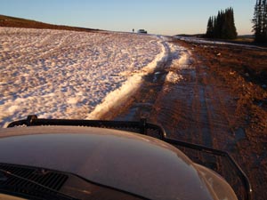
When we get to a snow field, the lead crew truck pulls a "Road Closed" sign out of the way, and we try driving further on, toward where last year's vet check was; finally the lead truck turns around and decides we should have the vet check below the snowfield, so nobody gets stuck or slides off the road. Good plan I say! The vets didn't object to the location when they arrived.
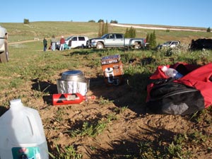
Steph unloads the truck with Kevin, Kevin and Rusty's crew gear and prepares food for the horses while I get out my camp stove, and put it together and start to boil water for the fresh Starbucks grounds I'm going to put in the French Press, so the boys can have some freshly brewed coffee like I promised them (after, of course, Steph and I have a serving first.)
As the water is starting to warm up, I realize I forgot the coffee grounds. I am crushed. I start having flashbacks to my Tevis crewing fiasco. ("Where's my Starbucks!? You didn't bring the Starbucks?!") Sadly, I dismantle the stove and pack it and the French press away.
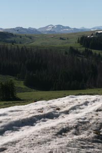
I climb up the steep hill to where I have a view of the trail where the riders will be coming from; indeed a panoramic view of the Big Horns. It's pretty stunning, pretty fantastic to be waiting for our riding friends who are crossing this immense country on horseback.
The biggest part of crewing is: waiting. You wait, and wait, and wonder, and sometimes worry. I tried calculating when they would arrive... supposedly this first section was 28 miles, so, at 6 mph, climbing most of the way, it should take around 5 hours, so somebody should be appearing around 9 AM.
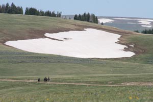
And sure enough in the distance, little moving dots became apparent. Across a broad high valley flanked by snowfields, the first 4 riders came my way.
Andy Bown is off jogging while tailing his horse.
The first riders drop down off the ridge into the vet check.
Our boys are all smiles when they come in not long after the leaders, and the horses look good so far.
Since I've forgotten the coffee grounds and can't provide coffee, my next most important job is remembering to remind the boys to plug in their GPS's during the vet check. A fully charged battery will only last around 11-12 hours, so it's vital to do this during the two 1-hour holds. As it is, the batteries might still run out near the end of the ride - in the dark - when you least want them to! GPS's have been absolutely essential in the last couple of years of this ride, in getting lost riders down off the mountain after getting lost in the dark, or having no marked trail to follow.
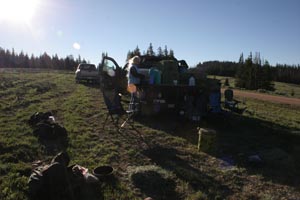
The boys rest while the horses chow down. They eat the whole hour.
In fact the boys, and us girls, eat well too, because Tim French has taken it upon himself to cook eggs and bacon for everybody at the vet check, along with coffee, made from fresh grounds!, out of the back of his truck! What a big unexpected treat that was! It tasted extra delicious being out in the boonies.
Everybody leaves out of this vet check; it's only (we are told) about 11 miles (!) to the next one. Laura's horse looks off, and Bill's might have something going on, but the vets let them go on since it's only about 11 miles to the next vet stop, where there's easy access for trailers. Kevin and Rusty and Kevin head out, all looking good so far!
"You can't miss vet check 2," we're told, "it's right off the highway. You passed it coming in this morning." I didn't notice it because I was too sleepy (probably not the best state for crew to be in), but Steph saw it, and we easily get to the next vet check in short order. It's at Antelope Butte ski area, a small affair but with cabins tucked in the woods, and a green meadow busting out in spring flowers at the moment.
This is where last year's rainstorm began that wreaked havoc for so many people in the ride, but this year the weather is perfectly clear, and still pleasantly cool up here at altitude.
We set up the horse and rider gear and food - Steph cuts the carrots up in little bites for our horses.
Bev Gray on Jolly Sickle, and Kerry Greear on Joe have taken over the lead coming into this stop. This is Jolly Sickle's second season and his second hundred. It's Bev's 50th (!) 100-mile ride. It's her 5th Big Horn - she finished 4 times, winning and getting BC on Paladin in 2001. It's Kerry's 3rd Big Horn 100 ride.
Our boys were a little late coming in to this check, having been passed by a handful of people. Oh no, we thought, did they get lost? Sure enough, after arriving, they said they'd lost the ribbons for a while. "Same place as last year!" Rusty said. But they knew where they were supposed to be going, and they had their charged GPS's on, so they were able to find the trail again, and continue on.
The horses ate their fill, switching between grain, hay, grass, alfalfa, and carrots. Far's favorites were the dandelions.
He rested more than the others, and he might have looked tired, but he was probably just conserving his strength because he knew how far he had to go yet (he finished last year with Kevin, as did Rusty and Rocky; it was Kevin W's and DE Golden Ali's first Big Horn 100). Besides, his CRI was 56-52, so he was doing well.
Bev and Jolly Sickle led the way out of Vet check 2, headed to Vet check 3, somewhere in the mountains at Battle creek.
We'd heard the mileage was "21" to vet check 3... but Steph had been told the same thing in 2006, and it had taken her 7 hours - no way it was only 21 miles. We expected the same inconsistency this year. This was also the part of the trail where 'some trail had been taken away, some had been added'... but nobody really knew how, where, or how far, since it had not been communicated to riders and crews by ride management at last night's meeting. We were prepared... but other riders were not. This big discrepancy would later affect some of the riders on the 100.
We sent our boys on their way after an hour hold, wishing them a safe journey. 39 miles down... ???how many?? to go!
Next up: The Final Stretch
Many more photos at:
http://www.endurance.net/international/USA/2011BigHorn/
Subscribe to:
Posts (Atom)