Tuesday August 30 2011
The trail kicked my butt.
We've still got miles of trail to explore for next year's City of Rocks Pioneer Trails Endurance Ride, by horse, by ATV, and by foot.
We've had our hopes set on using the loop up in the Albion Mountains around Independence Lakes. I've been dying to hike it. I love the desert and canyons where I live, but there's nothing like a ride or a hike over good alpine forest and lake trails.
"The entire hike should be about 11 to 12 miles so maybe six hours to hike depending on how fast you are." Forest Service Recreation Manager David Ashby, who earlier showed us around the upper forest service roads and trail heads, estimated the length, and said that on the northwest part of the loop, "the trail is there; it is just difficult to follow through some short sections, less than a quarter mile in length." No problem, i figured, I had a topo map of the loop (although without the trail marked on it) and a topo-less section map of the mountains (with the trail sketched on it), so between the two, I figured I couldn't get lost. If I managed to do that, there was a main road a couple thousand feet down and to the west of the mountain range, highways a couple thousand feet down and to the east and south of the range; and an interstate a couple thousand feet down and far to the north of the range if I really got lost.
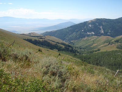
We had almost an hour of riding on the ATV to get to the end of the Forest Service road at the southwest corner of the Albion Mountains where the Independence Lakes loop trail started. Steph and Regina dropped me off... and I found I'd forgotten my maps (the second time in the last two exploring expeditions!) I glanced at Steph's map before I took off, trying to emblazon the route in my head. From my starting point, I could see the first saddle I was climbing to - which would look down on the lakes - and the last saddle I'd cross after looping around Mount Independence. I couldn't get lost.
"We'll be back to pick you up in 7 hours," Regina and Steph said, and they set off to scout other trails and roads on the ATVs.
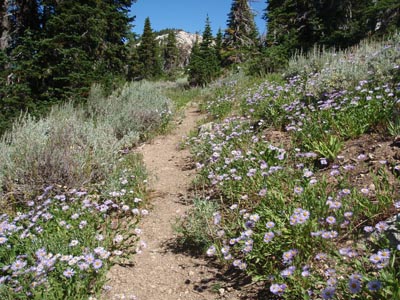
My hike started out at 8558' - and went up, through green alpine meadows redolent with the scent of blooming lupine and penstemmons. The intoxicating aroma and allure of the sub-alpine fir forest about knocked me over. There may be nothing better on this earth. Mount Independence loomed ahead of me, while behind me waves of mountain ranges gradually rose into view to the west.
The slope was moderate and the footing good (still great for an endurance ride...); but my pace slowed to a trudge the higher I crawled. I ride a lot, but I'm not in much hiking shape because it's too hot to hike where I live in the summer.
After eons, I finally gained the saddle at 9730' and crested the top - oh my.
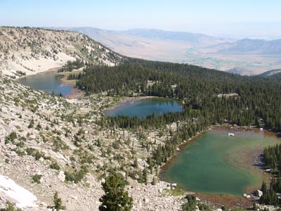
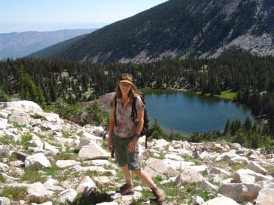
A staggering view of the cirque and 4 lakes came into view 500' below my toes. I stood a while to catch my breath from the climb and the view before heading down the rocky switchback trail on the steep southern face of Mt Independence.
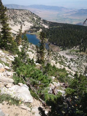
The trail wound down into and through the forested bowl of the cirque, skirting the lakes.
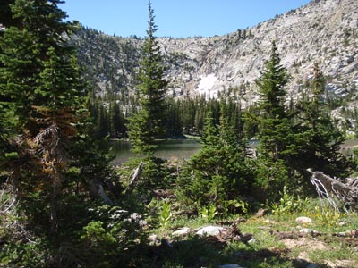
I almost went to roll in the snowfields still lounging on the slopes. I met one hiker climbing up the switchbacks, but the rest of the day I had the whole mountain to myself. The only other signs of human existence were the trail crews' campsite (but not the trail crew), and some fresh horse tracks from this morning (but no sighting of the horses or riders).
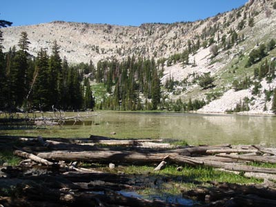
Leaving the bowl, the trail dropped away from the lakes several hundred feet to skirt the east and north side of Mt Independence. Alas, I was already realizing that, no matter how good the rest of the loop trail was, our possible endurance trail from basecamp at City of Rocks up into the Albions with a loop around Independence Lakes, is just too tough. While the mileage might be spot on for a 50-mile ride, it's too much to ask for horses to climb from 5800' at basecamp, up and up, to near 10,000', travel over some very rocky sections, then head back downhill 4200'. Especially on one day of a multi-day ride. But that didn't interfere with my sublime hike.
I easily made it to the trailhead on the north side of the loop at 7700', with 6 1/4 miles under my belt. I was tired... but at least halfway done. Probably. If I didn't get lost... since I didn't have a map and the trail might be hard to find.
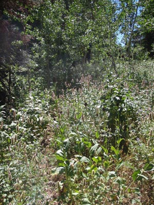
At times, it was just that! I started on the trail, then lost it. Then stumbled on a trail... overgrown path... or just a slight disturbance in the alpine flora... at times I was almost sure I was just on a game trail. I'd find it, lose it. Sometimes it was obvious; other times I'd just walk where a deer might go and find myself on a path again.
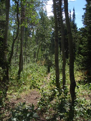
I knew I wanted to be following the Dry Creek drainage up to its saddle, which the faint trail was doing, so I knew I wasn't lost.
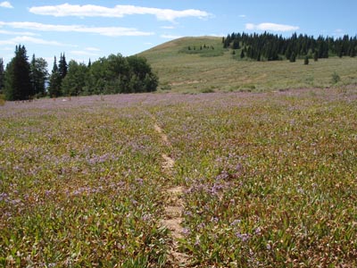
Reaching the saddle at 8200' the trails split: one headed the wrong way uphill, and two led downhill. Way downhill. No way I was going that far down into a drainage to have to climb back up. I could see where I wanted to finish, across the drainage, but at my altitude.
So I sidehill-bushwhacked, through thick gnarly aspen groves and waist-high skunk cabbage and assorted flora, over downed timber and thickly-bunched stunted firs (keeping my eyes peeled for cougars) along the upper slopes of Mount Independence, with a sweeping view of the valley far below to the west.
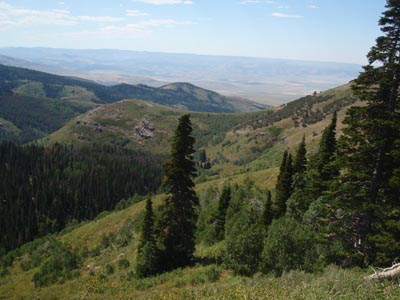
It's not easy crossing 40* slopes through brush and on crumbly rocks, your feet angled sideways and starting to ache in their boots, the sun beating down on you, and your original initiative and energy flagging. (Just sayin', not complaining; I was hiking in the mountains!)
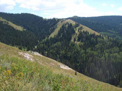
I finally saw a trail below - not the trail I was looking for, but I knew it had to end up at the same place - and opted to bushwhack down to take the easier route... and then ended up climbing on the trail, back up and regaining the altitude I'd lost.
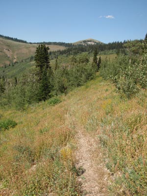
By the time I wobbled back out at my starting point, some 10 miles and 5 1/2 hours later, I was whooped. The trail had kicked my butt. Of course part of that might have something to do with not being in hiking shape, and the fact I rarely wear shoes except when I ride (and certainly not hiking boots!), and the altitude (I live at 3500').
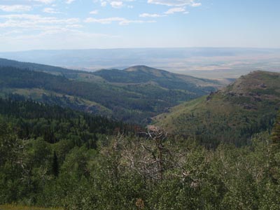
And even though you might call my hike a bust, since we won't be able to use this loop on our endurance ride, it was so worth every step, even the slogging ones over the last couple of miles where I had to stop and rest often so I could admire the view (and catch my breath).
Any day in the mountains is a great day! And today, on the Independence Lakes trail in the Albion Mountains, was one of those.
